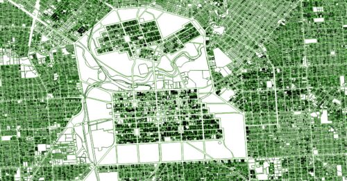
Land Services SA provides the most up to date South Australian Parcel Cadastre Maps and data, that can be further augmented with our property information. Leverage the most up to date cadastre maps for land administration, mapping and spatial analysis purposes.
Extend your research and planning by adding layers of relevant and up to date property data to cadastre. Join other top tier users who no longer settle for a basic cadastre and discover where the additional data can take you.
Why Land Services Cadastral Data?
- The only South Australian parcel cadastre that is updated daily.
- Select from hundreds of property attributes from our comprehensive data catalogue to add to your cadastre.
- Come direct to the source of SA’s property data.
- Access historical cadastres going back to 2019.
How can you leverage our data….
- Assess potential sites for renewable energy projects.
- Planning and infrastructure projects.
- Notification to land holders of mining exploration works.
- Surveying projects and fieldwork preparation.
- Update client GIS platform.
- Consulting for new projects.
Our Parcel Cadastre Data can be produced for any specific geographic area of interest, or for the whole of South Australia. One off requests, ongoing supply and refreshed data are available, whichever best meets your project requirements.
The data attributes included in our base cadastre data set are listed below. We also offer clients the advantage of including additional data attributes from our extensive range of property date. View the Land Services Data Catalogue understand the additional data attributes that can be mapped on your cadastre.
Please view our Parcel Cadastre Data Dictionary here for further assistance on selecting your attributes.
| Data field | Description |
|---|---|
| Plan_T | Plan type Plan type code (i.e.D = Deposited Plan, F = File Plan, S = Strata Plan, C = Community Plan, H = Hundred Plan) |
| Plan | Plan Number Alpha/numeric Plan number (i.e 1234) |
| Parcel_T | Parcel Type Parcel type code (i.e. A = Allotment, S = Section, Q = Piece, B = Block) |
| Parcel-Subtype | Subtype of the parcel This field indicates the type of parcel (i.e. AL = Allotment, AR = Allotment (Road), QP = Piece, BL = Block) |
| Parcel | Parcel Number |
| Title_T | Type of title. i.e.CL Crown Lease, CT Certificate of Title, CR – Crown record |
| Volume | Title Volume |
| Folio | Title Folio |
| Qualifier | When title fields are populated this field indicates that there is more than one title with ¿+titles¿, otherwise field left blank |
| Floor_Level | Floor level of the parcel extracted from the plan. Where a parcel spreads over more than one floor, there will be more be more than one record. |
| Date-From | Creation date of the parcel. |
| Parcel_Id | Id of the parcel in a format with space between the plan and the parcel. |
| Accuracy_code | The accuracy of each boundary corner is described by an accuracy code. The code ranges from 0 to 7 (improved accuracy is reflected by descending number). On digital output, this accuracy code is attached to other feature types (e.g.polygons). These coordinate values have been derived by computation using plan measurements and tertiary network survey marks for control. |
| Improved | This field indicates parcels that have been spatially improved. |
| DCDBID | Parcel Identifier, concatenation of PLAN_T, PLAN, PARCEL_T and PLAN values. In the form of D12345A67 |
| Planparcel | New Parcel ID field including the additional character for the Parcel Type |
| Shape_Length | Circumference of the shape representing the property in the cadastre. |
| Shape_Area | Area of the shape representing the property in the cadastre. |
Our Parcel Cadastre Data is easily modified to best suit your needs . We create the data, you choose the format.
- ShapeFile
- Geopackage
- CAD
If you have any other specific format requirements, just ask, we’re more than happy to work with you to meet your project needs.
Historical Cadastre
Access a wide range of historical cadastres covering the whole State of South Australia going back to 2019. These archives, subject to availability, contain not only all land parcel boundaries at time of extraction, many also provide overlays of additional datasets to augment your research.
Pricing
In South Australia cadastral data is not classified as open data, so it should be noted there is a State stipulated minimum fee of $250.00 ex GST.
Basic cadastre can be ordered for:
- whole state
- metro only (the 17 LGAs of ‘Greater Adelaide’)
- regional only (all other LGAs)
- rural only (by the ‘land use’ attribute)
- defined area of interest
Pricing is quoted on the number of parcels, ‘authorised purpose,’ frequency of refresh and if any additional data layers are requested. Please review the Data Supply Agreement for terms and conditions, importantly your ‘Authorised Purpose’ relates to the intended use of the data.
Request Quote
Please fill out this form to better understand pricing for your cadastre needs:
"*" indicates required fields
This form is protected by reCAPTCHA and the Google Privacy Policy and Terms of Service apply.